Kew scientists using drones to track scale of illegal deforestation
Drones can help curb illegal deforestation which is causing the loss of Madagascar’s biodiverse forests, according to a new study published today in the journal Plants, People, Planet.
Scientist Jenny Williams focused her research on a humid forest in the southeast of the island. She took a series of 19 ultra-high-definition drone surveys.
The senior spatial analyst’s work allows for the resulting data and 3D base maps to lead to the creation of an ‘effective alert system.’
It’s envisaged that such a system will help scientists, government agencies and local communities to protect Madagascar’s natural resources by creating an ‘immediate on-the-ground responses to deforestation.’

Madagascar is widely regarded for its exceptional biodiversity which has evolved over a period of 80 million years in near total isolation.
More than 80% of all plants and 90% of all animals found on the island are endemic, meaning they are found nowhere else on the planet.
However, Madagascar is also one of the world’s poorest nations and the pressures caused by poverty and the need to support livelihoods is putting the island’s biodiversity under increasing strain.
Humid forests: a target of illegal deforestation
For many years, Madagascar’s humid forests have been the target of illegal deforestation, driven by the overwhelming demand for firewood and charcoal.
Other systemic failures such as poor governance, corruption and weak law enforcement have contributed to the destruction of forests across various designated protected areas, including the area of her study (Ambohimahamasina).
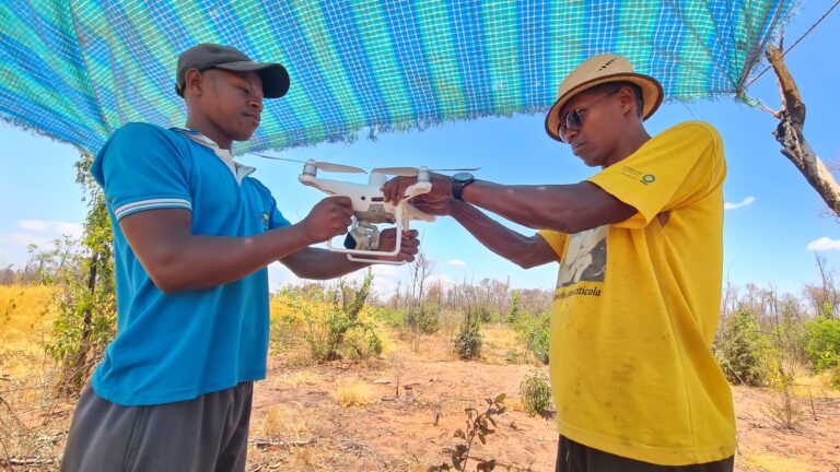
To better understand how and where these protected forests are being cleared, Jenny Williams, a senior spatial analyst at RBG Kew, has been flying drones over Madagascar over the past nine years.
Together with colleagues from the Kew Madagascar Conservation Centre (KMCC), she has been studying how the needs of local communities are fuelling illegal forestation and slash and burn agriculture.
‘The majority of the rural population in Madagascar are subsistence living, and they rely on charcoal as their only fuel source,’ explains Jenny Williams, Senior Spatial Analyst at RBG Kew.
‘As a result, the local forests are under tremendous pressure to supply all the resources for communities to survive.’
‘At the moment, this is not sustainable and so alternative livelihoods need to be developed if we want to protect these beautiful and unique ecosystems.’
‘There is a fine balance to strike between protecting Madagascar’s forests and protecting the wellbeing and livelihoods of its people and this is central to the work Kew has been doing here since the 1980s.’
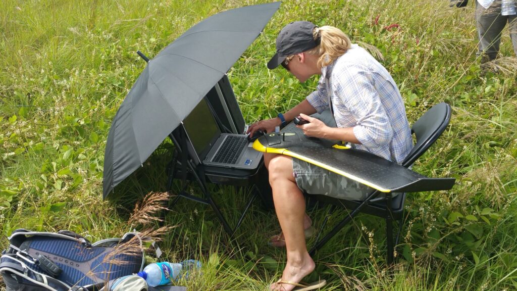
Using a drone: capturing more than 2400 images over a 27 square kilometre area
In total, Jenny accumulated 485 flying minutes across 19 flights with drone during a four-day period in May 2019.
Unlike conventional quadcopter drones readily available to the public, she used a fixed-wing drone, meaning it looks and operates like a plane with a single powered rotor to generate lift.
Using this bit of kit, Jenny captured more than 2,400 pictures over a 27 square kilometre area of contiguous forest.
Unfortunately, the surveys detected many sites of illegal logging within the protected area, as well as the clearing of forest for agricultural purposes.
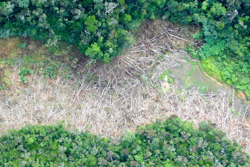
Image: Jenny Williams / Copyright: RBG Kew.
The two largest clearings measured 412 and 86 hectares and were located near to surrounding communities.
To tackle the issue an early warning deforestation system was developed between the scientists and a non-governmental organisation (Ny Tanintsika). Ultra-high definition maps were provided to help with the project.
The charity, Feedback Madagascar, along with their local partners Ny Tanintsika played a key role in the project by funding and running the logistics for the drone expedition.
Alert systems warning of illegal deforestation
The alert system warns a ground-based crew about possible instances of illegal deforestation, prompting them to head out into the field to verify the alarm.
By working directly with the affected communities, scientists are hopeful this will help to prevent instances of deforestation in the future.
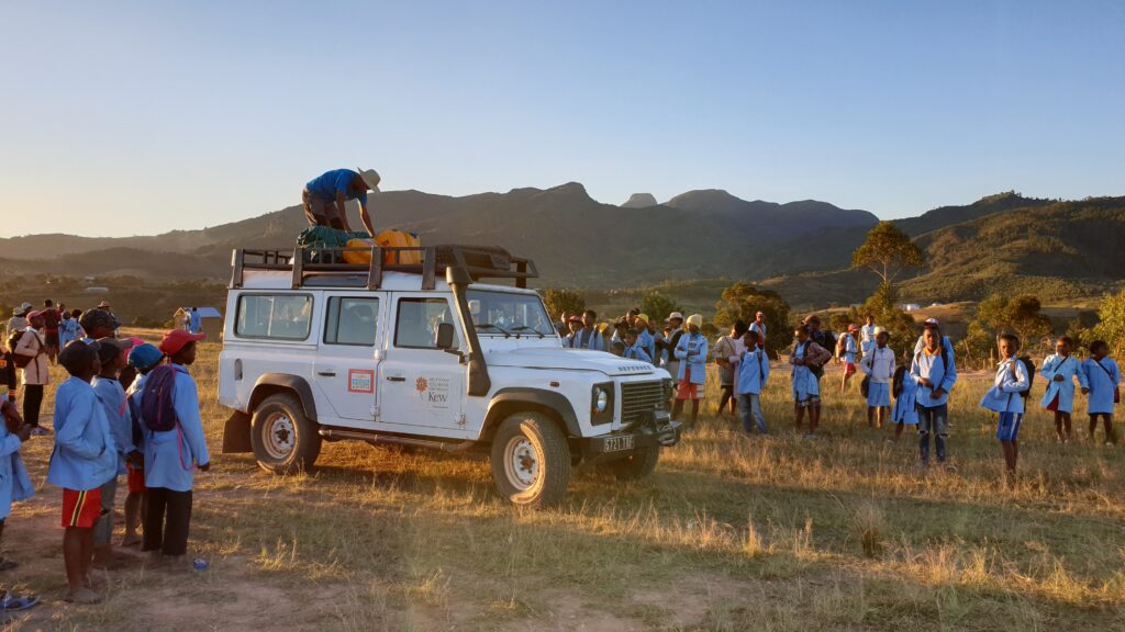
Working directly with local communities. Image: Jenny Williams / Copyright: RBG Kew.
The project was supported with funding from the SOS Lemurs initiative, the International Union for Conservation of Nature (IUCN) and Global Forest Watch (GFW).
‘We are working closely with many local communities to help them protect their forests, while developing alternative sources of food and livelihoods.’
‘Investing in these communities is key to the success of any conservation or restoration program and we are currently trailing this approach in the UNESCO World Heritage dry forests in Ankarafantsika National Park.’
Scientists say protecting Madagascar’s forests is not just about stopping deforestation but is also about building resilience back into the landscape and the communities that rely on it.
As such, Kew’s scientists are prioritising their work around: finding the right trees to plant, planting trees in the right place, planting trees at the right time, using the right fuel to support community wellbeing and using tools to monitor the ecosystem.
In other parts of the world, researchers have been using teams of paramotoring experts to explore plant species with the aim of protecting them within their habitats.